2754
Proceedings of the 18
th
International Conference on Soil Mechanics and Geotechnical Engineering, Paris 2013
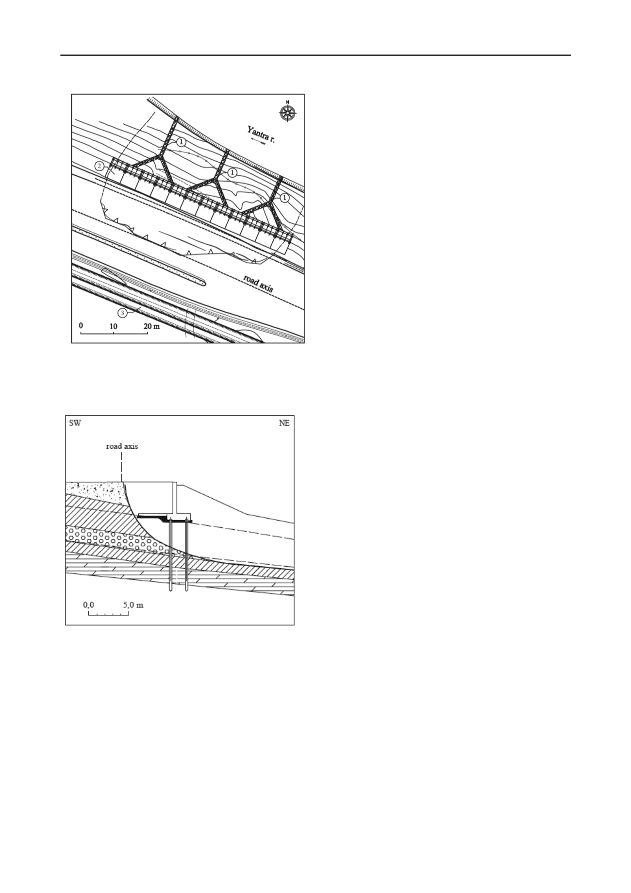
Figure 3. Layout of stabilizing structures
1 - deep trench drains with branches; 2 - retaining wall with trailing
plate on driving pile foundation; 3 - deep horizontal interception
drainage
Figure 4. Cross-section through the retaining structure
4 CONCLUSIONS
Conducting investigation of activated landslide leads to
following conclusions:
The investigated slope consists of Quaternary deposits
covering Lower Cretaceous marls. Activated landslide is
caused by combining influence of river erosion due to high
water tables of Yantra River, low strength parameters of
quaternary clays, temporary rise of ground water levels
from rain water infiltration, static loading from road
embankment and dynamic impact of passing vehicles.
For quality strengthening of road section passed trough
activated landslide has been constructed reinforced
retaining structure on pile foundation, combined with
trailing plate. Piles are embedded in a strong soil layer
beneath the sliding surface. The structure has been
designed for the pressure from landslide materials and
under earthquake condition.
Drainage system includes interceptor trench drain aligned
parallel to the road toward the slope and deep trench drains
between the retaining wall and the river. The designed
system allows the infiltrated surface water from rains and
snow melting to be drawn aside through the culvert to the
river without further moistening of landslides materials.
The installed monitoring system for observation of
displacement of stabilized road section shows that
constructed retaining structure and drainage system are
functioning successfully.
ACKNOWLEDGEMENTS
Present investigation has been funded by Road infrastructure
agency part of Ministry of Regional Development and Public
Works of Bulgaria.
REFERENCES
BS-EN 1997. Eurocode 7-1 "Geotechnical design. National annex"
Chrischev, Chr. (ed.). 1990. Geological map of Bulgaria. Sheet Veliko
Tarnovo, scale 1:100 000.
Bulg. Geol. Survey
, 1.
EN 1997 Eurocode 7 " Geotechnical design "
Glavcheva R., and N. Dobrev. 2012. Inventory of past earthquakes in
Bulgaria and searching for geodynamical effects at archaeological
sites.
5th Int. Conf. 110 anniversary of the seismological survey in
Azerbaijan, 2012, 487-499
.
Ivanov, P., N. Dobrev. 2006. Results from laboratory tests of samples
from Fore-Balkan landslides.
Proc. National Sci. Tech. Conf. on
Landslides and Erosional Processes in Bulgaria, Prof. M. Drinov
,
155-160.
Kolev, Ch. 2006. General criterion for optimization of complex
retaining systems.
National Scientific conference” Conditions and
controlling of landslides and erosion in R.Bulgaria” Academic
Publisher “Prof. M.Drinov”.
pp.131-134.
.


