2260
Proceedings of the 18
th
International Conference on Soil Mechanics and Geotechnical Engineering, Paris 2013
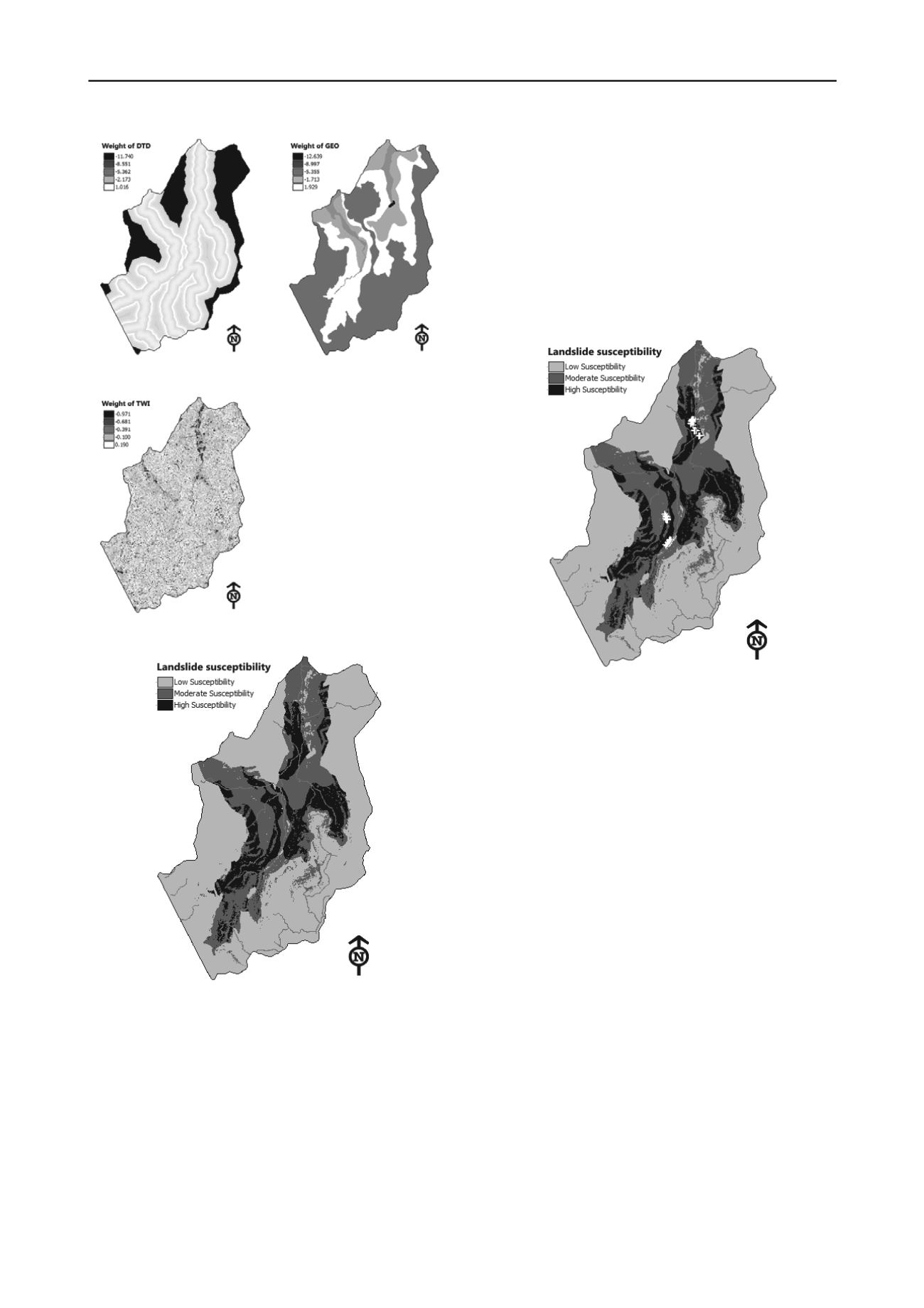
Figure 8. Weight of DTD factor
Figure 9. Weight of geological
factor
Figure 10. Weight of TWI factor
Figure 11. Landslide susceptibility map
3 CONCLUSION
a) The landslide susceptibility map shows that most of
landslide occurences concentrate at the areas of low elevation
(100~200m), gentle slopes (slope angles vary from 5° to 20°),
high TWI values (high water accumulation).
b) Landslides are also triggered due to the road construction.
The roadway cuts into the slope faces and reduces the stability
of slopes. Landslides occurs near the road construction sites
(approximate 100m far from roads).
c) Landslides also distribute along the east-west direction
which coincides with the direction of narrow valleys of steep
slopes in the study area.
d) The results of Bayesian conditional probability model and
the fieldwork survey show that landslides occur usually in soil
layers with high proportion of clay and diatomite clayey soils
which are heavily weathered.
e) The Bayesian conditional probability model gives the
reliable result of landslide susceptibility for the study area. The
validation was conducted for 39 heavy landslide positions
which show that there are 31 positions (80% accuracy) located
in the high landslide susceptibility zone.
f) The reliability of this model could be improved year after
year when new landslide occurences are updated annually in the
landslide inventory.
Figure 12. Landslide location for model validation (39 points)
4 REFERENCES
Bonham-Carter G.F. 1994.
Geographic Information Systems for
Geoscientists: Modelling with GIS
, Volume 13 (Computer Methods
in the Geosciences). Pergamon.
Brett G. Dickson et al. 2006. Mapping the Probability of Large re
Occurrence in Northern Arizona, USA.
Landscape Ecology
(21),
747-761.
Chung C.F. and Fabbri A.G. 1999. Probabilistic Prediction Models for
Landslide Hazard Mapping.
Photogram Engineering Remote
Sensing
(65), 1389-1400.
Chung C.F. and Fabbri A.G. 2003. Validation of Spatial Prediction
Models for Landslide Hazard Mapping.
Natural Hazards
(30), 451-
472.
Lee S., J. Choi , K. Min. 2002. Landslide Susceptibility Analysis and
Verification Using the Bayesian Probability Model.
Environmental
Geology
(43), 120-131.
Raul Romero-Calcerrada et al. 2008. GIS analysis of spatial patterns of
human-caused wildre ignition risk in the SW of Madrid (Central
Spain).
Landscape Ecology
(23), 341-354.


