30
Proceedings of the 18
th
International Conference on Soil Mechanics and Geotechnical Engineering, Paris 2013
Proceedings of the 18
th
International Conference on Soil Mechanics and Geotechnical Engineering, Paris 2013
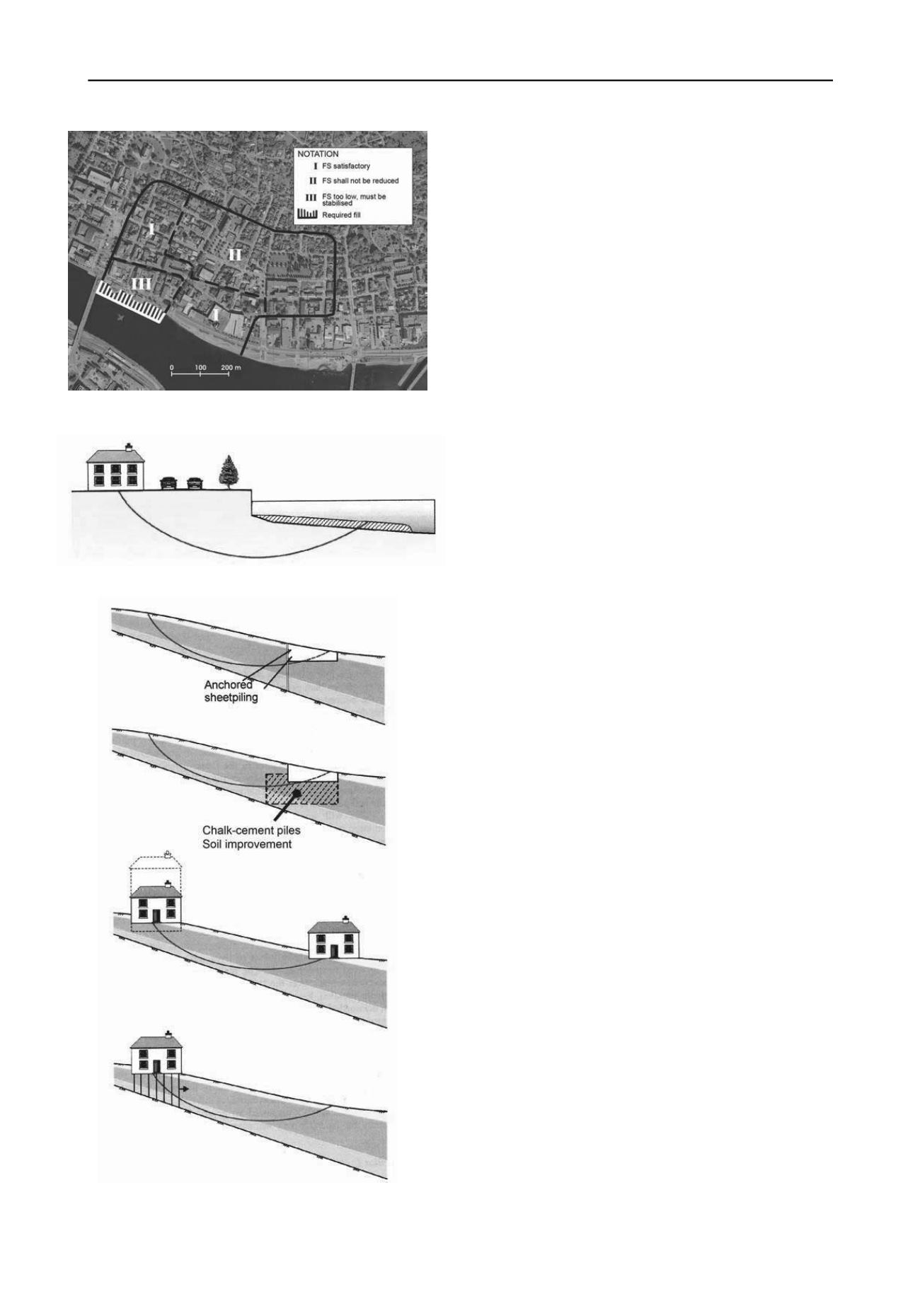
Figure 34. Classification of hazard zones in Drammen (FS = safety fac-
tor) (Gregersen, 2008).
Figure 35. Mitigation in hazard Zone III in Drammen.
Figure 36. Mitigation and preventive measures in Zone II in Drammen.
11.2
The SafeLand Project
The need to protect people and property in view of the changing
pattern of landslide hazard and risk caused by climate change
and changes in demography, and the need for societies in
Europe to live with the risk associated with natural hazards,
formed the bases for the 2009-2012 SafeLand project “Living
with landslide risk in Europe: Assessment, effects of global
change, and risk management strategies”.
SafeLand was an integrating research project under the
European Commission’s 7
th
Framework Programme. The pro-
ject involved 27 partners from 12 European countries, and had
international collaborators and advisers from China, India,
USA, Japan and Hong Kong. SafeLand also involved 25 End-
Users from 11 countries. SafeLand was coordinated by NGI’s
Centre of Excellence “International Centre for Geohazards
(ICG)”
/). Nadim and Kalsnes (2014) pre-
sent the results of the project in more detail. The objectives
achieved in the SafeLand project include:
‐
Guidelines related to landslide triggering processes and run-
out modelling.
‐
Development and testing of empirical methods for predict-
ing the characteristics of threshold rainfall events for trig-
gering of precipitation-induced landslides, and development
of an empirical model for assessing the changes in landslide
frequency (hazard) as a function of changes in the demogra-
phy and population density.
‐
Guidelines for landslide susceptibility, hazard and risk as-
sessment and zoning.
‐
New methodologies for the assessment of physical and so-
cietal vulnerability.
‐
Identification of landslide hazard and risk hotspots in
Europe. The maps show the location of the areas with high-
est landslide risk and allow a ranking of the countries by
exposed area and population.
‐
Simulation of regional and local climate change over re-
gions of Europe at spatial resolutions of 10 x 10 km and 2.8
x 2.8 km. The simulations were used for an extreme value
analysis of trends in heavy precipitation events, and subse-
quent effects on landslide hazard and risk.
‐
Guidelines for the use of remote sensing, monitoring and
early warning systems.
‐
Development of a prototype web-based "toolbox” of inno-
vative mitigation measures. The toolbox does a preliminary
assessment of the appropriateness of the measures and a
ranking of over 60 structural and non-structural landslide
risk mitigation options.
‐
Case histories and "hotspots" of European landslides were
collected and documented. Data for close to fifty potential
case study sites (Italy, France, Norway, Switzerland, Aus-
tria, Andorra, and Romania) were compiled. Almost all
types of landslide and types of movement were represented.
‐
Stakeholder workshops and participatory processes to in-
volve the population exposed to landslide risk in the selec-
tion process for the most appropriate risk mitigation meas-
ure(s).
11.3
Slope safety in Hong Kong
The best example worldwide of a comprehensive and effective
program of risk management for landslides is probably the slope
safety program administered by the Geotechnical Engineering
Office (GEO) of the Civil Engineering and Development De-
partment in Hong Kong. The Slope Safety System has seven
main targets:
‐
Improve slope safety standards, technology, and administra-
tive and regulatory frameworks.
‐
Ensure safety standards of new slopes.


