551
Applicability of the RNK-method for geotechnical 3D-modelling in soft rocks
Applicabilité de la RNK-méthode pour la modélisation géotechnique en 3D en roches tendres
Ivšić T.
University of Zagreb, Faculty of Civil Engineering, Kačićeva 26, 10000 Zagreb, Croatia
Ortolan Ž.
J. J. Strossmayer University of Osijek, Faculty of Civil Engineering, Drinska 16a, 31000 Osijek, Croatia
Kavur B.
Institut IGH d.d., Janka Rakuše 1, 10000 Zagreb, Croatia
ABSTRACT: The RNK-method or the Reference Level of Correlation method represents a procedure for spatial engineering-
geological and/or geotechnical modeling, that was tested on many landslides in Croatia. The method gives the opportunity of
differentiation of minimum shear strength zones, zones of different hydraulic conductivities, and zones of various soil densities. The
application and verification of the RNK-method in soft rock formations found on the landslide area in Gorica Svetojanska (Croatia) is
presented. The presentations providing the full set of relevant information needed to develop representative geotechnical profiles are
also shown. The established geotechnical sliding model is verified by measurements of lateral movements in the landslide area and by
results of corresponding stability analyses
RÉSUMÉ : La RNK-méthode (méthode du niveau de corrélation de référence) représente une procédure de modélisation spatiale en
génie géologique et/ou géotechnique, qui a été testée sur plusieurs glissements de terrain en Croatie. La méthode permet la
différenciation des zones de la résistance de cisaillement minimale, des zones des conductivités hydrauliques différentes, et des zones
de densité du sol diverse. L'application et la vérification de la méthode RNK aux formations rocheuses tendres, trouvés sur un site de
glissement de terrain á Gorica Svetojanska (Croatie) sont présentées. On présente aussi un ensemble complet d’informations
pertinentes pour développer les profils géotechniques représentatifs. Le modèle géotechnique de glissement établi est vérifié par les
mesures de mouvements latéraux dans la zone de glissement, et par les résultats d’analyse de stabilité correspondante.
KEYWORDS: RNK-method, plasticity index, shear strength, slope stability, spatial geotechnical model.
1 INTRODUCTION
1.1
The site description
The village Gorica Svetojanska is located in hills area in north-
western part of Croatia. In last several years the intensive
cracking of the walls of local church has been observed. Also,
the soil movements at the slope with graveyard down the church
have been noticed, as well as damages of the small mortuary
structure.
The church of St. Anastasia (St. Ana, “Jana” in local
dialect) is situated at the plateau of narrow ridge dominating the
nearby valley (Figure 1). The church at this position is
mentioned in historical parish records from second half of 18
th
century. It was several times reconstructed and strengthened
after damages caused by stronger earthquakes in late 19
th
century.
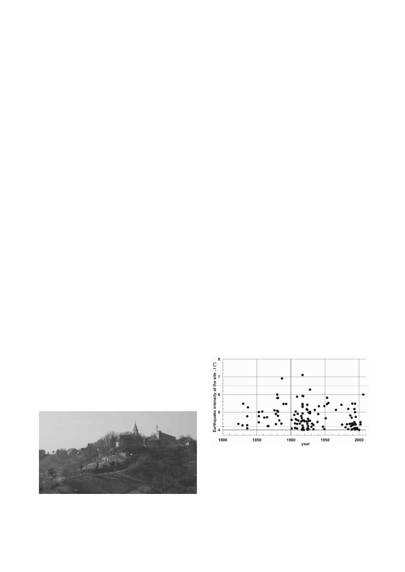
Figure 1. The St. Ana church with graveyard.
1.2
Local conditions
The site is in seismically active region and in Figure 2 the
frequency of earthquakes (with I > 4º) in last 200 years is
shown, supporting the parish records.
The seismic intensities at the church location have been
estimated by common attenuation function compiling the
catalogue records of earthquakes with epicentres in radius R =
75 km from the site (GZ, 2005).
Figure 2. The frequency of moderate and strong earthquakes at the site
In geological profile, generally, the ridges and hills in the
vicinity have the less permeable soft rocks and clayey soils in
upper part, and older, permeable aquifers in lower part of
profile. The aquifers are recharging at higher elevations,
producing artesian or sub artesian groundwater pressures at the
village site. Also, in the vicinity, the mineral water is
commercially extracted and bottled.


