3135
Technical Committee 301 /
Comité technique 301
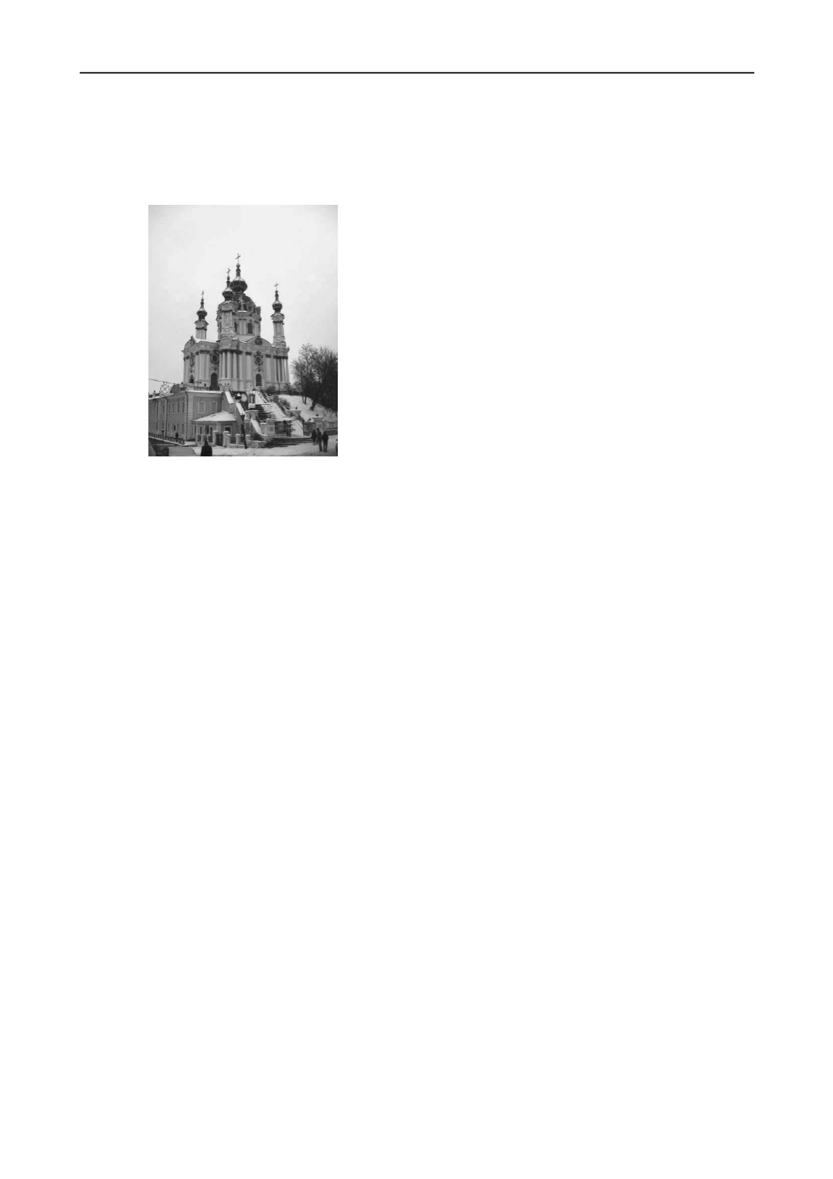
decor, game of light and shade, is characteristic for. A church is
erected on tailings of earthen fortress of 17
th
century. Building
is crowned with the central dome and four angular decorative
towers. Sizes of church are: length 32 m, width 20 m, height
from a terra
50 m.
erosive processes
d
he unfavorable physical and geo-
ticles of sandy loam and
art of parvis, joins to underground fundamental part
o
t which hangs
o
. The moraine loams serve as basis of foundations of east
p
e characterized by the presence of
u
pe slides appeared the principal reason of
fo
e necessity of urgent im-
plementation of reconstruction works.
ce to the top of cross of central dome
Fig. 9. The St. Andrew’s church.
The territory of the St. Andrew’s church is located in over-
head part of central historical part of Kyiv. The marks of hill
surface change from 181.7 m (the planned ground round a
church) to 118.5 m (the hill bottom). Slopes are dismembered
by spring-beam network, an active slide and
eveloped and develop on them.
Within the building area, t
logical processes take place:
- landslide and landslide-prone slopes;
- considerable layer of collapsible soils;
- substantial heterogeneity of soils on the building area;
- mechanical suffusion of silt par
sand to the existent neglected gallery;
- surface erosion of the hill massif.
Visible part of the church building leans against greater in
lay-out underground two-story fundamental part. An entrance to
the church is arranged by cast-iron stairs which connect a street
with parvis. A stylobate – two-story building, coverage of
which is a p
f church.
Foundation is executed of masonry posts of 3 to 5 m width.
The foundation base of the church beds on different marks: in
western part – from 166,6 to 165,8 m; in east par
ver a hill – from 165,7 to 167,8 m.
Basis of foundations of the south, west and north facades are
eolian-deluvium loess sandy loams which are collapsible at sat-
uration
art.
The hydrogeology terms ar
nderwater of two levels.
It was discovered at the complex inspections of building, that
it had substantial damages, main of them were through cracks,
local destructions of clout layer and build solution of masonry.
The uneven settling of basis, conditioned the presence of col-
lapsible soils and slo
und out damages.
The technical state of church building was appraised as unapt
for normal maintenance that caused th
2.2. General conception of reconstruction works
The reconstruction works of the St. Andrew’s church were
executed after the followings directions:
- geotechnical measures;
- repair and strengthening of the damaged structural members of
building;
- restoration of facades and interiors;
- improvement of the technical state of surrounding territory.
The geotechnical measures were:
- research and analysis of geological conditions of the territory
of the St. Andrew’s church;
- research, analysis and prognosis of changes in geological con-
ditions and mode of hydrogeology of adjoining territory with
development of hydrogeology model;
- research and analysis of slope stability on the area of the St.
Andrew’s church and adjoining territory;
- research of modern erosive processes of slopes on this area;
- research and analysis of stress-strain state of the ground basis
of building.
On the results of geotechnical researches the design decisions
were developed.
2.3. Realization of geotechnical researches.
- Improvement of the hydrogeology mode.
For adjusting of underwater level, in addition to existent
drainage system, a new drainage pipeline, located in the space
after retaining wall on a slope, is erected.
The basic setting of the drainage system is an intercept of
ground-water non-admission of saturation of soils in the space
after retaining wall, as it increases ground pressure on a wall
and diminishes local slop stability near-by a wall. The drainage
system helps to avoid additional infiltration of atmospheric wa-
ter additional getting up of water level in the piles zone.
The drainage system consists of two separate pipelines, lo-
cated along retaining wall, which throw down water from oppo-
site sides in a sink. From a sink the fault of water is foreseen by
an underground pipe – collector in the existent overflow-pipe
well of the drainage gallery system.
- Analysis of slope stability.
In obedience to the requirements of national building code,
the value of normative factor of slope stability must be not less
than 1.25.
For implementation of analysis of slope stability a design
complex SLIDE-5 used. The complex has wide possibilities of
calculations and interpretation of results – by 9 methods simul-
taneously (methods of Bishop, Yanbu, Spenser, Fellenius and
others).
For the increase of reliability of results the analysis of slope
stability were executed also by the program «BOBR», devel-
oped on the base of Terzaghi-Chugaev method. Comparison of
the got results showed that they coincided in a sufficient degree.
Thus, stability factors on lower and overhead areas by the
«SLIDE-5» program are 1.015 and 1.229, by the «BOBR» pro-
gram – 1.083 and 1.219.
On the basis of historical materials study, visual inspections
of adjoining to the church building slopes and executed analy-
sis, there was determined that considerable part of slopes of the
St. Andrew’s church hill are in the state close to the maximum
equilibrium.


