2234
Proceedings of the 18
th
International Conference on Soil Mechanics and Geotechnical Engineering, Paris 2013
Figure 2. Schematic representation of the geological aspects of the slope
1.1.1
Geotechnical parameters
As given above we have identified two main type of terrain.
The limestone rock formations with very good mechanical
characteristics and flysch formations that are very weak rocks to
soils.
These last rocks are described as rocks with relatively low
strength and high deformability. They can be easily eroded by
water, have a plastic behavior and poor stability on the slopes.
Volume weight ranges from 2.2 - 2.6 g/cm
3
, porosity up to 35%,
elasticity module 2 * 10
3
-10
4
daN/cm
2
, compression strength 5 -
25 daN/cm
2
, intact rock cohesion 20 100 kPa, internal friction
angle <15 °.
Based upon the lab test and empirical evaluation the main
geotechnical parameters for unweathered formations used in the
design are as follows
Table 1. Geotechnical main parameters
Layer
g
s
c
F
Flysch/Clay
23
20-100 15
Limestone
26
400
45
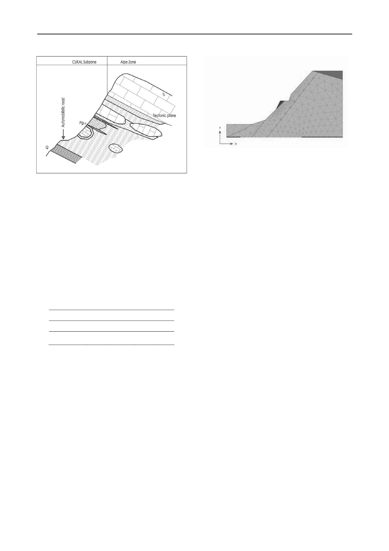
2 MODELING OF THE SLOPE
2.1
FE 2D model
The slope stability analysis is made with finite element
software Plaxis. The geometry and the layers are given in figure
3. For the calculation of sliding slopes should be distinguish the
existing slides as well as those caused by changes in loading,
reduction of parameters so first time slides. In finite element
numerical calculations for the new slide slopes can not
predefined a critical surface along its length the strength
mobilized parameters progressively softened. The problem must
pass in two stages, initially determining a critical sliding plan (if
any) and then to give the soil strength mobilized parameters of
this plan
the residual parameters.
Through the first model we can determine the stability of the
slope for a long time while the second model we can define the
engineering measures (walls, piles, anchored wires, nails, etc. )
and make the their design.
Figure 3. FE model of the slope
The soil is modeled as elasto-plastic material with yield
criterion of Mohr-Coulomb. Advanced models with softening
behavior would be more appropriate, but for lack of data (as
well as the impossibility of accurate assessment of softening
process) in our case can not be used. Weathering processes have
been taken into account by dividing a surface layer in which the
strength parameters gradually increase in depth until intact
rock/soil values. In each analysis we took into account the
initial natural stages as well as the following stages during the
construction and the final stage during exploitation.
Influence of time, the accumulation of deformation, creep,
brittle behavior that manifest same old overconsolidated clays,
the formation of shear bands, influence of existing fissures,
change of resistant parameters along the extent of the critical
sliding surface, etc. in our model can not be taken in
consideration. However, this modeling by taking the average
parameters gives us practical results for the controls of the slope
stability and dimensioning of retaining structures in the final
limit state of the slope.
The fillings for road widening are reinforced with geogrids.
Slope nailed wire mesh, anchors are simulated by applying a
surface pressure perpendicular to the slope. The value of the
pressure is taken such that the safety coefficient of the second
model after application of this pressure to be 1.25.
Plaxis program allows a sensivity analysis to see the influence
of each parameter to the stability of the slope.
2.2
Water influence
The zone is one of the wetest zone in Albania with a average
rainfall of 1750mm/year. It is well known that the rainfall
precipitation degrade the soil properties due to progressive
weathering. The weathered soil material has filled the
longitudional channel blocking the dewatering. The water
infiltrate through existing fissures reducing significantly the soil
parameters. The flysch/old clay formation have been separated
into two soil layers. Upper surface layer that has been weakened
as a result of rain water infiltrations and bottom layer of the
terrain representing the intact formation. We haven’t used an
underground water level and thus a seepage calculation because
in this type of formation we can not speak for a real water level.
The water influence is taken into account only between the
reduction of surface layer parameters and increase of the
thickness of this layer at the end of the excavated slope, toe of
the slope. For the surface layer geotechnical parameters that are
used are the residual parameters c
r
,
F
r
.
2.3
Seismic input
One of the reasons of slope instabilities are seismic events. So
for the long term stability in the seismic zones is necessary to do
also slope seismic loads analysis. Seismic input can be
considered from time history of acceleration. These time


