2210
Proceedings of the 18
th
International Conference on Soil Mechanics and Geotechnical Engineering, Paris 2013
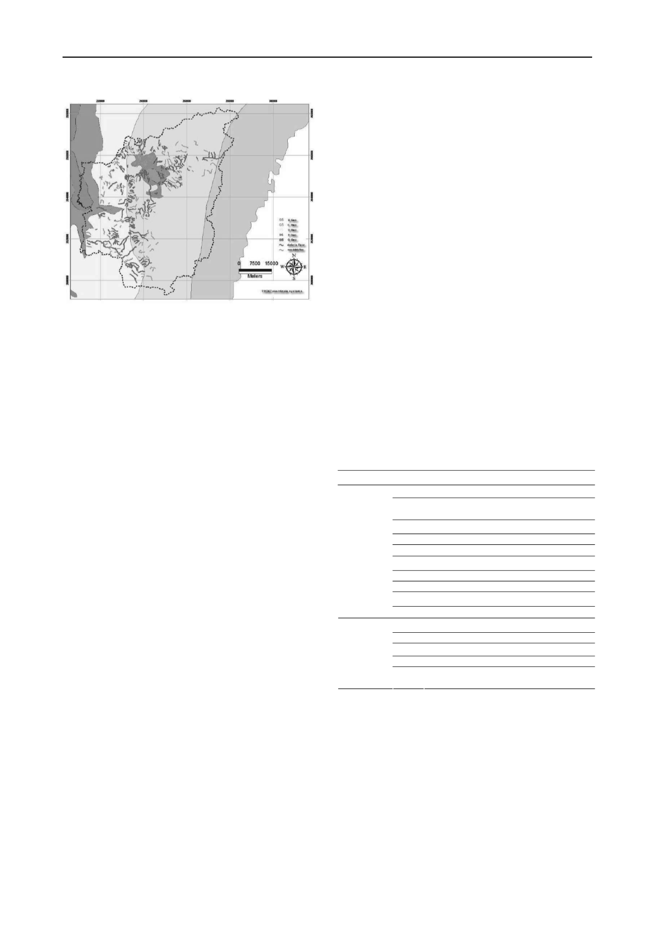
Figure 1, most of the debris flow torrents in Nantou County distribute in
C zone and D zone.
In order to perform the discriminant analysis, database for both
debris flow torrents and non-debris flow torrents are constructed
as discussed in the followings:
a. Debris flow torrents: the debris flow torrents in research area
are based on the debris flow torrents published by Soil and
Water Conservation Bureau in 2003 in 1/5,000-scale. The total
number of debris flow torrents in the research area is 199. The
watershed of each debris flow torrent was generated using DEM
accordingly.
b. Non-debris flow torrents: The procedures for establishing the
non-debris flow torrents are to establish watersheds and streams
based on the 1/25,000 topographic map and DEM, and are not
debris flow torrents by SWCB (Lin, et al. 2003). The non-debris
flow should be in the neighboring area of debris flow torrents
and with similar geologic traits and watershed size. Accordingly,
a total number of 175 non-debris flow torrents was generated in
the research area. Cross examination of these torrents were
performed by comparing the torrent distribution to the aerial
photograph. The results appeared to be consistent, and the
distribution of the non-debris flow torrents is as shown in
Figure1.
3 INFLUENCE FACTORS AND THEIR SIGNIFICANCES
The necessary conditions for triggering debris flow include
affluent debris materials, sufficient water supply, and
appropriate geomorphological conditions. For evaluation of
debris flow potential, the influence factors were selected based
on the three conditions, and the database were generated. Based
on previous researches (Lin, et al. 2003, Lin and Chen, 2005,
and Lin and Wen, 2006), eight influence factors are selected as:
watershed area, streams length, hypsometric integral, form
factor of basin, stream mean slope, slope angle, slope aspect,
and geology formation, respectively.
1. Watershed area: BA, in hectare. The watershed with larger
area usually contributes more water, which is regarded as a
factor related to the water supply.
2. Stream length: SL, in meter. Stream length means the
largest length of the stream in the related watershed. The longer
the stream length is, the larger the watershed area is. Stream
length is also regarded as another factor of sufficient water
supply.
3. Hypsometric Integral: HI, dimensionless. The hypsometric
integral is determined from the integral of the basin’s height
versus area percentage curve, which is a characteristic of
geomorphic evolution of the watershed. It also stands for terrain
ruggedness and is regarded as a factor related to the abundance
of debris material.
4. Form factor: Form factor, FF (dimensionless), is proposed
by Horton in 1920, and is defined as the basin area divided by
the square of stream length. A higher form factor suggests
broader basin shape, and different basin shapes affect flow
hydrograph of the stream (Robet and Raymond, 1978).
5. Stream mean slope: SMS, in degree. Stream slope is an
important factor related to flow velocity; the steeper the slope is,
the faster the stream flow. The stream mean slope serves as an
indicator of appropriate slope conditions.
6. Slope aspect: N, NE, E, ES, S, SW, W, WN, in percentage
of area ratio. Most debris flow disasters were triggered by
typhoon or heavy rainfall. According to the landing path of
typhoons, rain falls concentrated more on windward side.
Strong wind also influences the weathering process. Slope
aspect serves as an indicator of geomorphlogical condition.
7. Slope
distribution:
SD10(0°~10°),
SD15(10°~15°),
SD20(15°~20°),
SD30(20°~30°),
SD45(30°~45°),
SD90(45°~90°), in percentage of area ratio. Steeper slope has a
higher tendency of slope failure and leads to more debris
material.
8. Geological formation: E1, E2, EO, Mj, Ml, MS, My, O1,
O2, O3, P1, P2, Q2, Q3, Q0, as listed in Table 1, in area ratio
percentage. Weak rock quality, complicated geologic structure,
highly developed fault and fold, and intensive tectonic activity
zone tend to provide abundant debris material. Different
geological formation contributes to different material strength,
degree of fracture, and soil type.
The influence factors were derived from fundamental data
through performing spatial and hydrological analysis using GIS
and the related database were established. The distributions and
characteristics of the influence factors of debris flow torrents
and non-debris flow torrents are compared and discussed.
Table 1. Geological formations of the study area
Category
Symbol
Rock Type
E1 Slate, interlaminations of slate and sandstone
E2 Indurate sandstone with carbonaceous slate
interbeds
EO Slate, phyllite, with sandstone interbeds
Mj Sandstone, shale
Ml Argillite slate phyllite sandstone interbeds
MS Sandstone, shale
O1 Quartzitic sandstone, slate, graphitic shale
O2 Argillite, indurate sandstone, slate
Q2 Gravel, laterite, clay, sand
Metamorphic
Rock
(C Zone)
Q3 Clay, sand, gravel
My Sandstone, shale
O3 Sandstone, shale
P1 Shale, sandy shale, mudstone
P2 Sandstone, mudstone, shale
Sedimentary
Rock
(D Zone)
Q0 Sandstone, mudstone, shale, conglomerate
(limestone)
During the analysis, it was found that the distribution of
factors for different engineering geological region had different
characteristics with significant effects on triggering of the debris
flow; the potential analysis of the study area was conducted on
whole area with combined geological zones, Zone C, and Zone
D, respectively. The number of debris flow and non-debris flow
torrents in Zone C are 99 and 95, and 54 and 54 in Zone D as
shown in Figure 1. In order to conduct the statical analysis, the
independcy and significance level of each influence factor was
checked using analysis of covariances and Pearson Test. A
significance level of 0.1 with 90% of confidence was chosen,
and it appeared that the influence factors selected were
independent of each other. The resulting significant influence
factors for the whole area, Zone C, and Zone D are listed in
order of level of significance in Table 2. Due to the complexity
of the geological characteristics when the whole area was


