74
Proceedings of the 18
th
International Conference on Soil Mechanics and Geotechnical Engineering, Paris 2013
Proceedings of the 18
th
International Conference on Soil Mechanics and Geotechnical Engineering, Paris 2013
a)
b)
c)
Figure 6. The Temple of Juno at Akragas (Agrigento). a) The
calcarenite cliff; b) An aerial view; c) An outline of its foundations
Cotecchia et al. 2000).
The rational layout of the Greek town, Akragas, is only one
of the many discoveries made (Fig. 6). Actually it is clear that
the designers took into account the geomorphological
characteristics of the area and they adopted solutions for the
foundations that contemplated the properties of the soils and the
seismic nature of the area (Cotecchia 1997, Cotecchia et al.
2000). Indeed, the foundations of the structural elements of all
the temples, consisting of large calcarenite blocks were placed
on the rigid and resistant calcarenite layer located at several
metres depth, underneath the Pliocene outcrop of a medium
hard clay: the foundation of the temple of Hera Lacinia is
located at more than 7 metres below ground surface. Does this
mean that the Greeks knew about the local amplification of
seismic action induced by the clay layer? The ruins of Jupiter’s
Temple, that had been built previously and that had collapsed
before its completion, suggest that this may be the case.
Being acquainted with all the details of a monument’s
history is essential in studying how to conserve it and in finding
the best measures to ensure its conservation without
undermining its original characteristics.
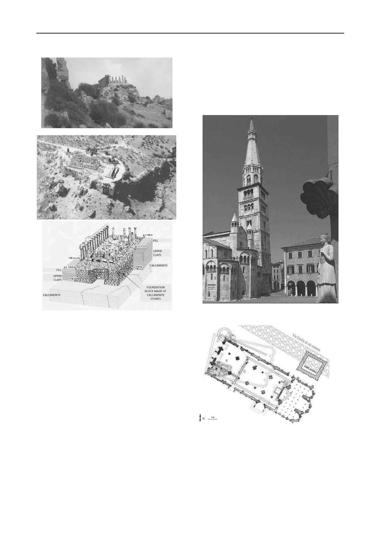
The recent study of the static condition of the leaning tower
Ghirlandina in Modena (Figs. 7, 9) is a beautiful, outstanding
exemplary demonstration of the importance of deep historic
knowledge for explaining the nature and origin of the damages
and of the effective contribution offered by a thorough
geotechnical investigation. The Ghirlandina, that was designed
by Lanfranco, a famous medieval architect, and built from 1099
to 1319, has a total height of 89 m; presently its axis has an
inclination of 1°16' against the vertical, that is not increasing. In
recent years there has been a widespread concern about the
possible seismic vulnerability of the tower and an in-depth
research has been carried out on its static and dynamic
equilibrium conditions (Lancellotta, 2007, 2013). The main
problem was whether the tower had a sufficient stability factor
against a seismic action of assumed intensity.
Figure 7. The Cathedral and the Ghirlandina tower at Modena. A view
of the leaning tower and the Cathedral apse.
Figure 8. The planimetric positon of the various historic buildings and
of the ancient Roman road Aemilia (Lancellotta 2013).
The geotechnical characteristics of the site are very
complex. Actually the foundation soil is a succession of
geologically recent alluvial deposits, covered by a thick (more
than 6 m) layer of ancient, man made heterogeneous landfills.
The upper horizons down to about 22 m are formed by medium
to high plasticity inorganic clays, with an abundance of thin
laminae of sand and peat. The geological, geotechnical and
geophysical investigations showed that various periods of
emersion during the deposition of the thick alluvial deposit
generated a series of layers overconsolidated by desiccation.


